Senior Honors Thesis
For my Senior Honors Thesis, I researched GIS applications for measuring Indigenous voter disenfranchisement. The paper offers new spatial analysis approaches that address polling location accessibility, legislative district compactness, low Indigenous voter registration rates and turnout impacts on election results. This paper is significant given the historical marginalization of Indigenous communities and resulting distrust of American political institutions. My research cultivates a more inclusive conversation around disenfranchisement and democratizes the spatial methods used to analyze it.
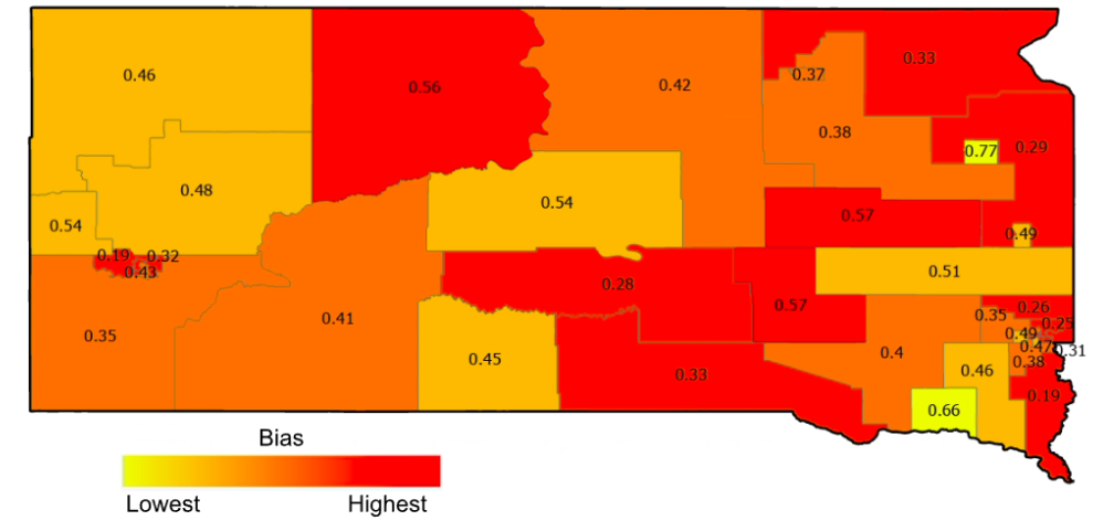
Polsby-Popper compactness scores by legislative district
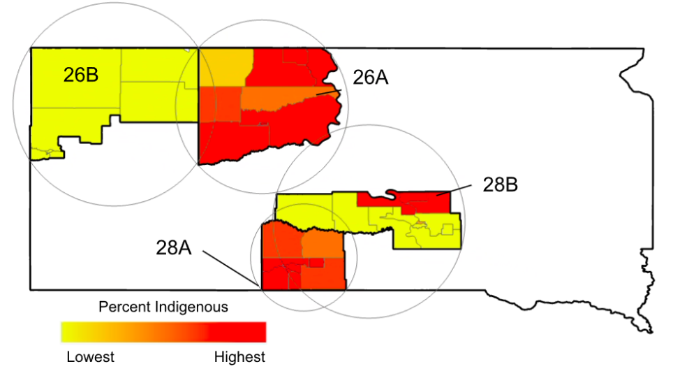
Reclassified Indigenous citizen voting age population (CVAP) counts by block group for South Dakota split lower legislative districts (SLLD) with Reock minimum bounding circles
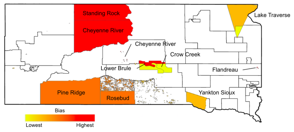
Aggregate Indigenous reservation compactness scores, overlaid with legislative districts
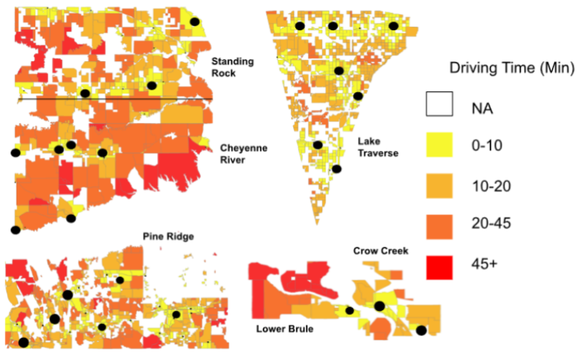
Driving times from block centroids to polling centers on Indigenous land